Model:
SUUNTO X10Code:
SS014005010
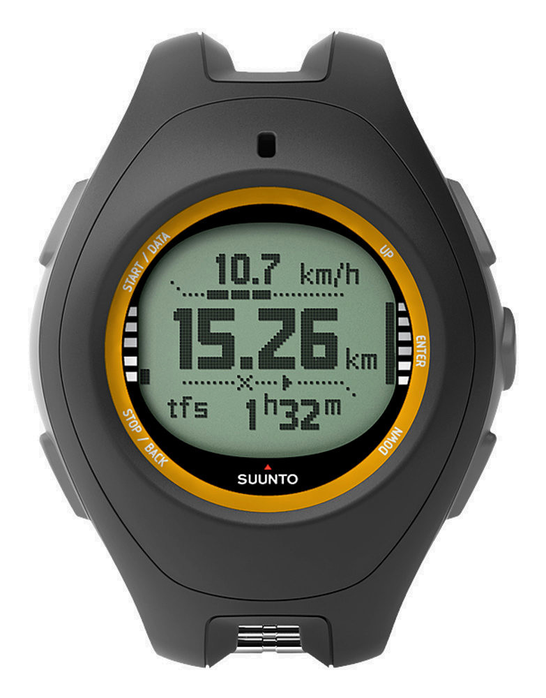
Smallest and lightest outdoor sports instrument with full GPS navigation
The package contains:
- SUUNTO X10 SS014005010
- Extension strap
- AC charger
- PC interface cable
- User's guide
- Pocket guide
- CD with Suunto Trek Manager and Suunto Track Exporter software and user's manual
The ultimate outdoor tool
Living up to the expectations of its predecessors, the Suunto X10 features a GPS tracking system that is faster and more accurate, with more robust performance in harsh conditions. It also has a longer battery life and is USB chargeable, making it the ideal companion for adventurers.
Before the trip
For added preparation, use the Suunto Trek Manager software before your journey to create routes and plan your journey. You can also use one of several commercial PC software products that are compatible with Suunto X10 and allow planning and viewing of your hiking and trekking trips on a PC using digital outdoor maps.
During the trip
The Suunto X10 continuously checks the barometric pressure, so you can always stay one step ahead of the weather. In addition to the altimeter, compass, and barometer use the GPS to better navigate to up to 500 waypoints throughout your journey. You can set the Suunto X10 to Activity Mode to record your speed, distance, and altitude information, and any memory points you define along the way. With the improved, faster GPS fixes - even under heavy foliage - and longer lasting battery power, you can navigate confidently and conveniently, while keeping your hands free. Once you reach your destination, set your Suunto X10 on Track Back mode to be guided back the way you came.
After the trip
Connect your Suunto X10 to your PC and use Suunto Trek Manager to review your journey and visualize its altitude profiles. Use Suunto Track Exporter software to upload your journey to Google Earth™ where you can plot and show your progress and share it with family and fellow outdoor enthusiasts.
When everyone knows where you've been and how you got there, the pressure is on to find new places. With the Suunto X10, the earth is your playground.
View tracks on Google Earth™
The Suunto Track Exporter software allows you to export tracks from your Suunto X10 to Google Earth, where you can view your adventures anywhere on the globe with real satellite imagery. Once exported to Google Earth, you can relive your adventures, zooming from outer space to distances as close as 200 feet with detailed resolution. You can also show progressions of your trips with three-dimensional flyovers from start to finish, and share the excitement of the adventures with anyone who uses Google Earth by emailing the tracks or posting them on a website.
Third party software
There are several commercial PC software products that are compatible with Suunto X10 and allow planning and viewing of your hiking and trekking trips on a PC using digital outdoor maps.
Products compatible with Suunto X10 include National Geographics TOPO!, Austrian Map, CompeGPS, Fugawi, German Top-Map Series, MagicMaps and Memory-Map.
- GPS: record routes, mark waypoints, track speed and distance
- Google Earth™ compatible
- Altimeter, barometer , compass
- Time, dual time, calendar, multiple alarms, stopwatch
- Water resistant up to 100 meters/300 feet
- Menu based user interface
- PC interface software and USB cable
- Light (only 76g) plastic housing
Altimeter
| Altitude alarm |
✓
|
| Vertical speed |
✓
|
| Temperature compensation |
✓
|
| User-removable logbook files |
✓
|
| Resolution |
1 m |
| Altimeter/barometer lock |
✓
|
| Altitude range -500m - 9000m/-1600ft - 29500ft |
✓
|
| Logbook function |
✓
|
Chronograph
| Stopwatch |
✓
|
| Max number of split times in memory |
29 |
Compass
| Automatic magnetic declination adjustment |
✓
|
| North-South indicator |
North indicator |
| Guided calibration |
✓
|
| Heading in degrees |
✓
|
| Declination setting |
✓
|
| Cardinal directions |
✓
|
| Bearing tracking |
✓
|
GPS
| Distance |
✓
|
| GPS Resolution |
1m / 3ft |
| Routes |
50 |
| Speed |
✓
|
| Tracks |
25 |
| Waypoints |
500 |
Other
| Weight |
76 g |
| Operating temperature |
-20°C - +60°C/-5°F - +140°F |
| User replaceable straps |
✓
|
| Water resistance |
100m/330ft |
| Selectable metric/imperial units |
✓
|
| Menu-based user interface |
✓
|
| Dot-matrix display |
✓
|
| Backlight type |
Led |
| Backlight option for night use |
✓
|
PC Software
| Software name |
Suunto Trek Manager and Suunto Track Exporter |
Power
| Battery power indicator |
✓
|
| Rechargeable battery |
✓
|
| 115-240 VAC charger |
✓
|
Watch
| 12/24h |
✓
|
| Stopwatch |
✓
|
| GPS time syncronization |
✓
|
| Calendar clock |
✓
|
| Dual time |
✓
|
| Daily alarms |
3 |
Weather
| Absolute barometric pressure |
✓
|
| Weather memory |
7 days |
| Weather alarm |
✓
|
| Trend graph |
✓
|
| Altimeter/barometer lock |
✓
|
| Temperature |
✓
|
| Sea level pressure |
✓
|